#ICELAND 4. BEACHES AND ICEBERGS. [Jokulsarlon. Skaftafell. Vík]
We drive 276 km on the South of Iceland visiting the rainiest part of the country, hiking in Skaftafell and sailing with icebergs.
We woke up very soon in our guesthouse in Hofn (check last article) (if I’m not wrong, I think it was 4 am) because sun was already up and daylight had woken us up (dawn is very soon in summer in the north! It was 5 September). We had breakfast with our colleagues the owners’ cats (they had thick fur, by the way) and with the horses they had in their piece of land. After that, we got in our way to one of the most well-known touristic attractions in Iceland: Jokulsarlon.
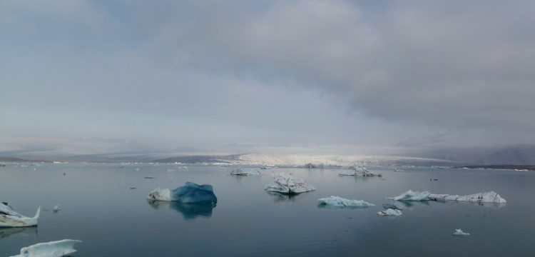
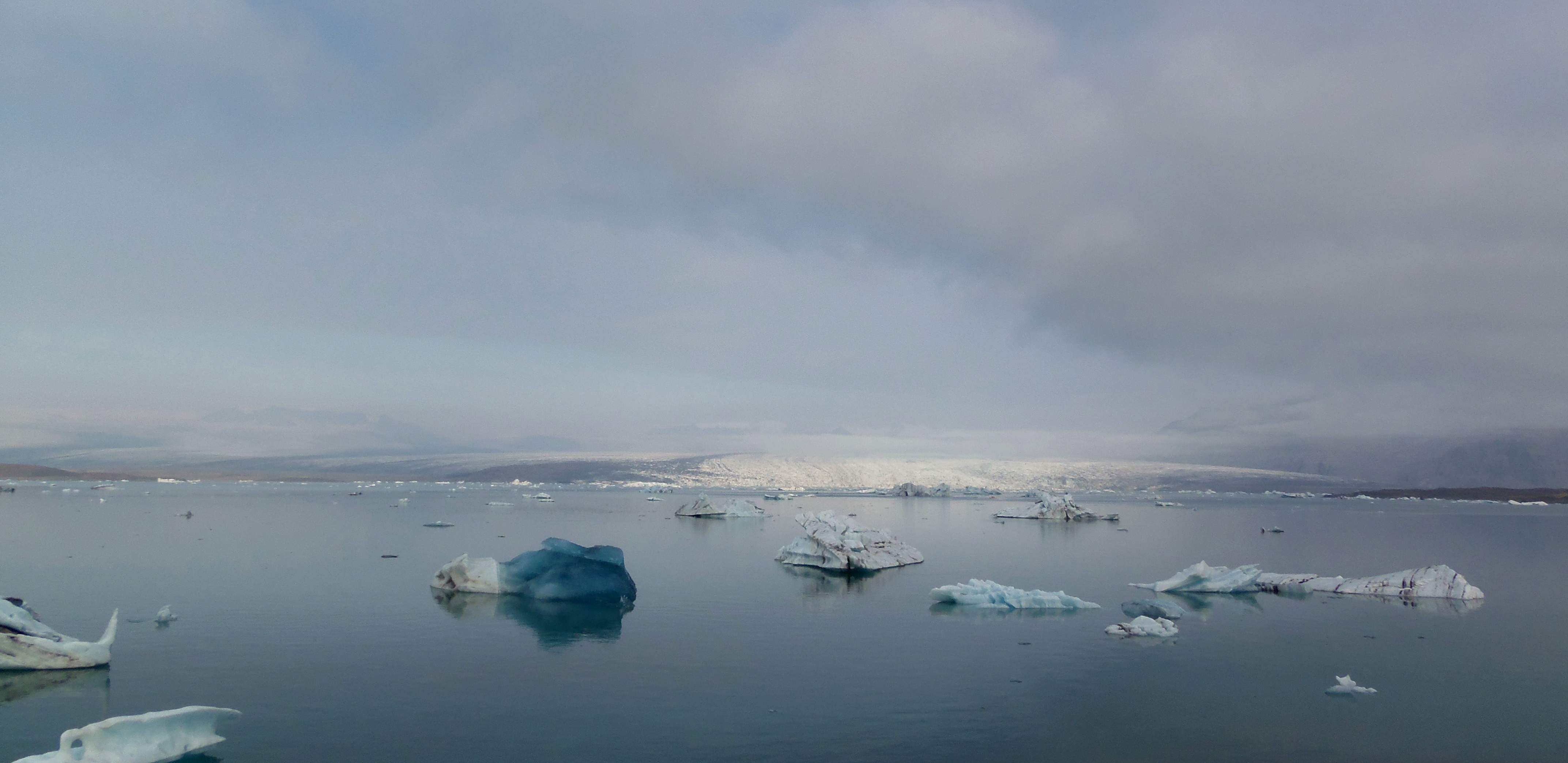
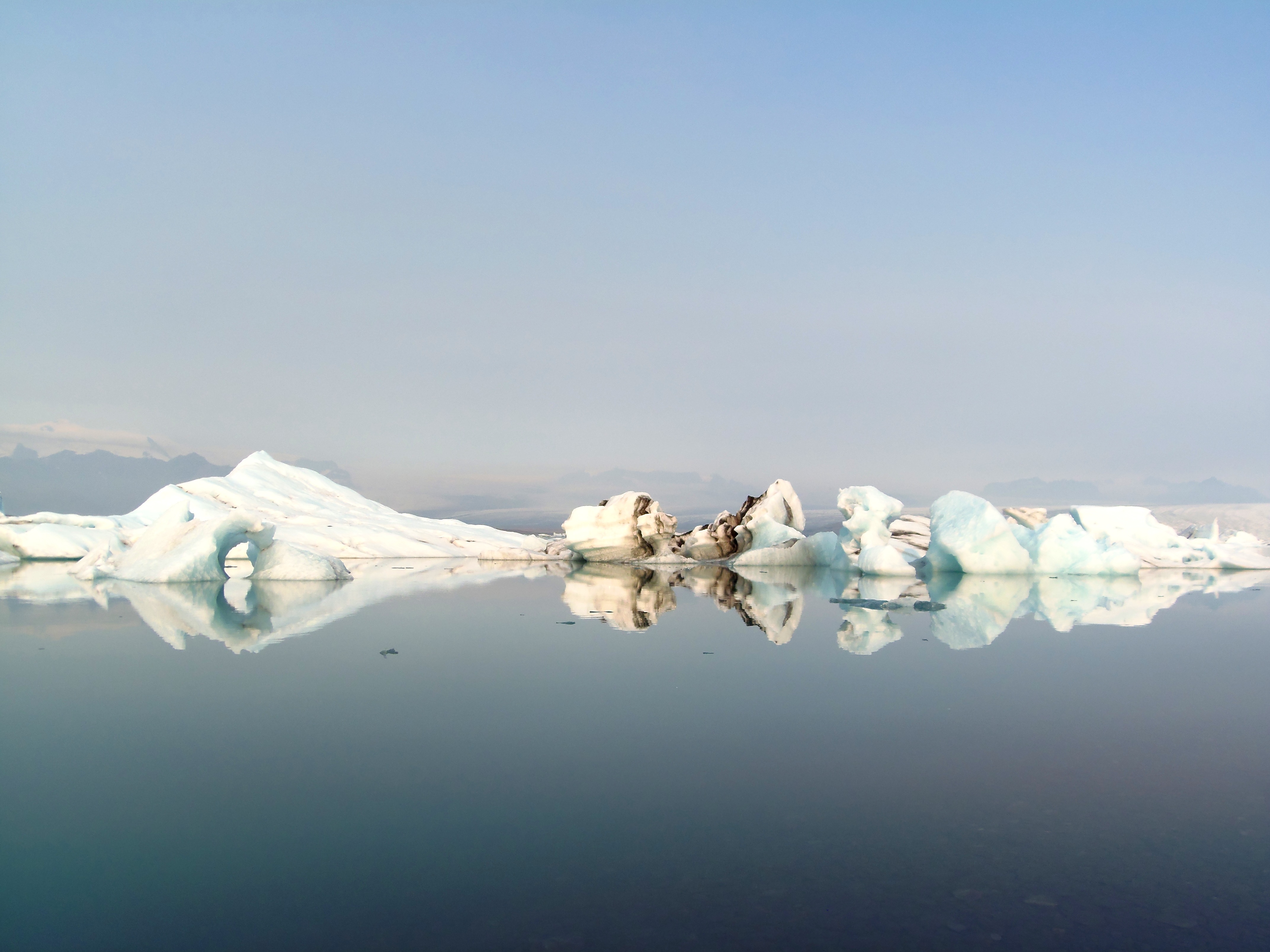
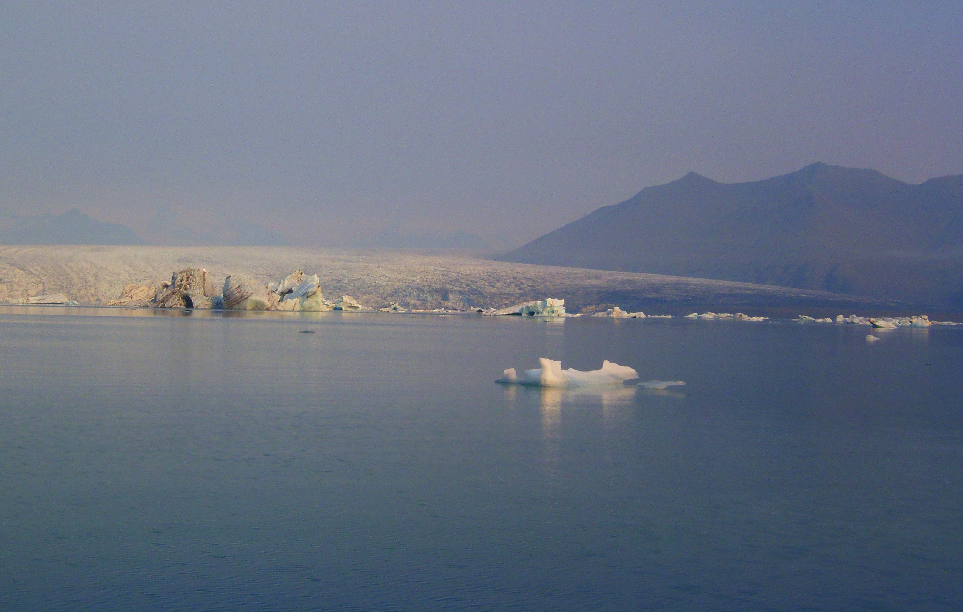
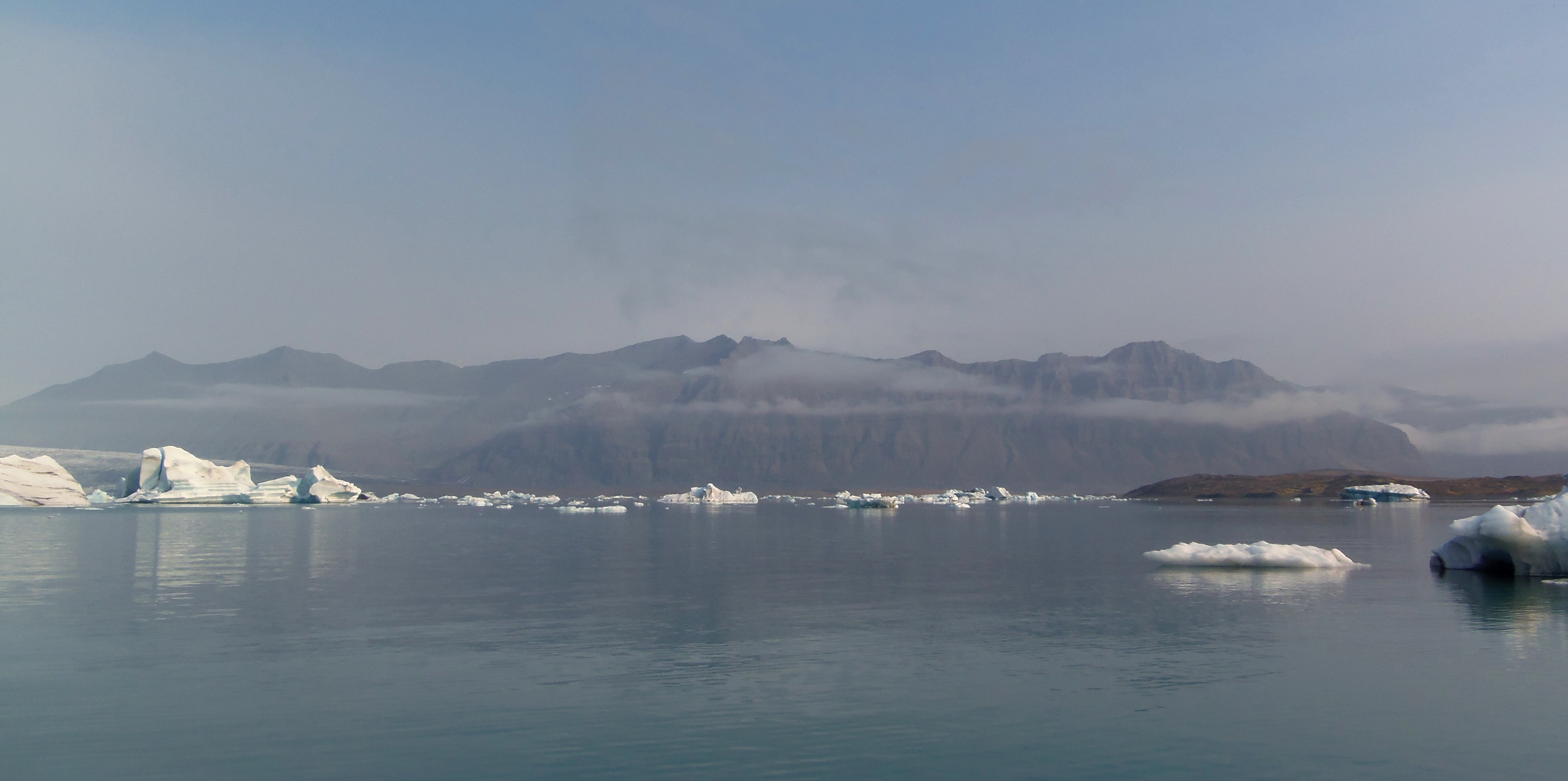
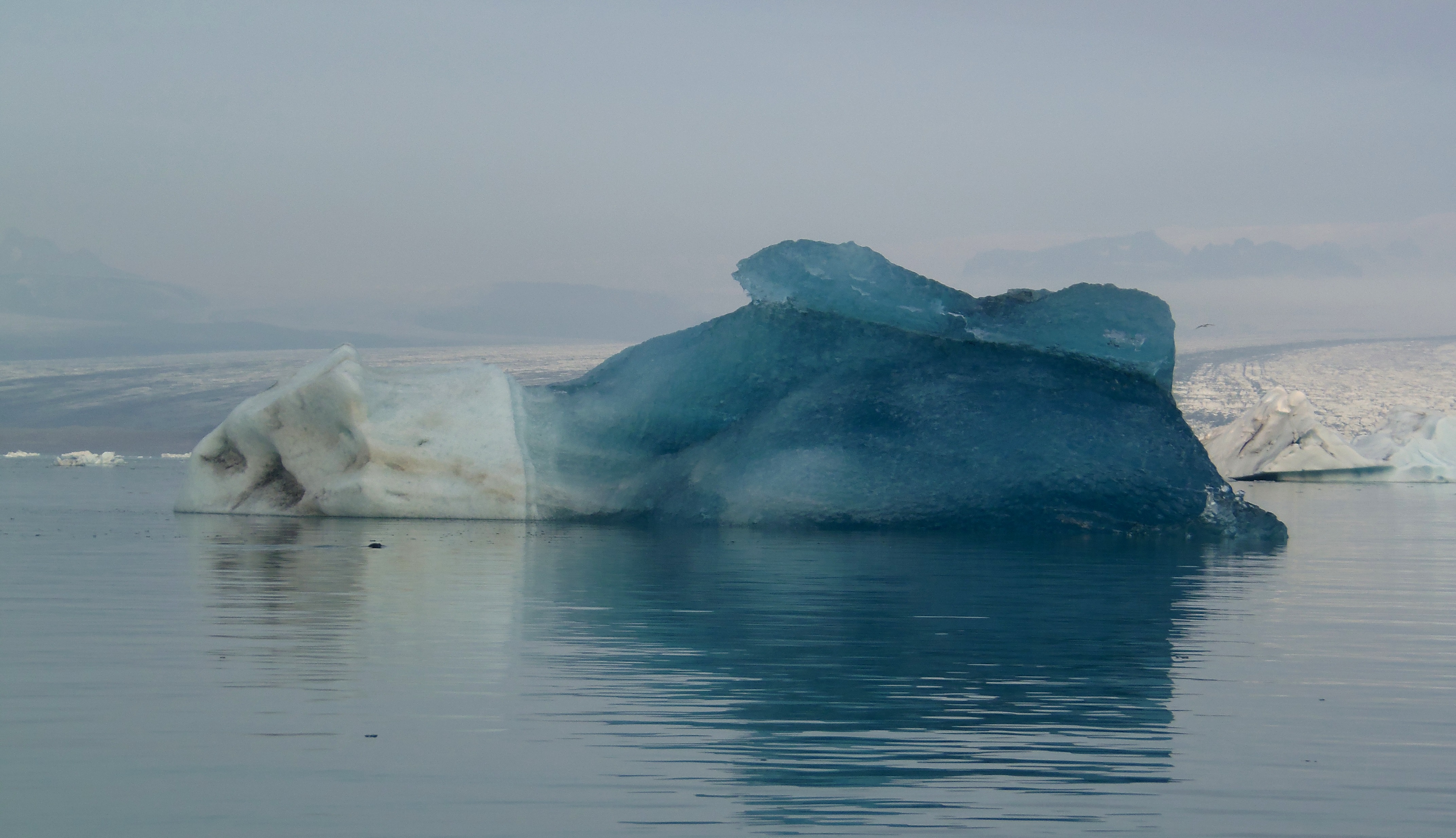
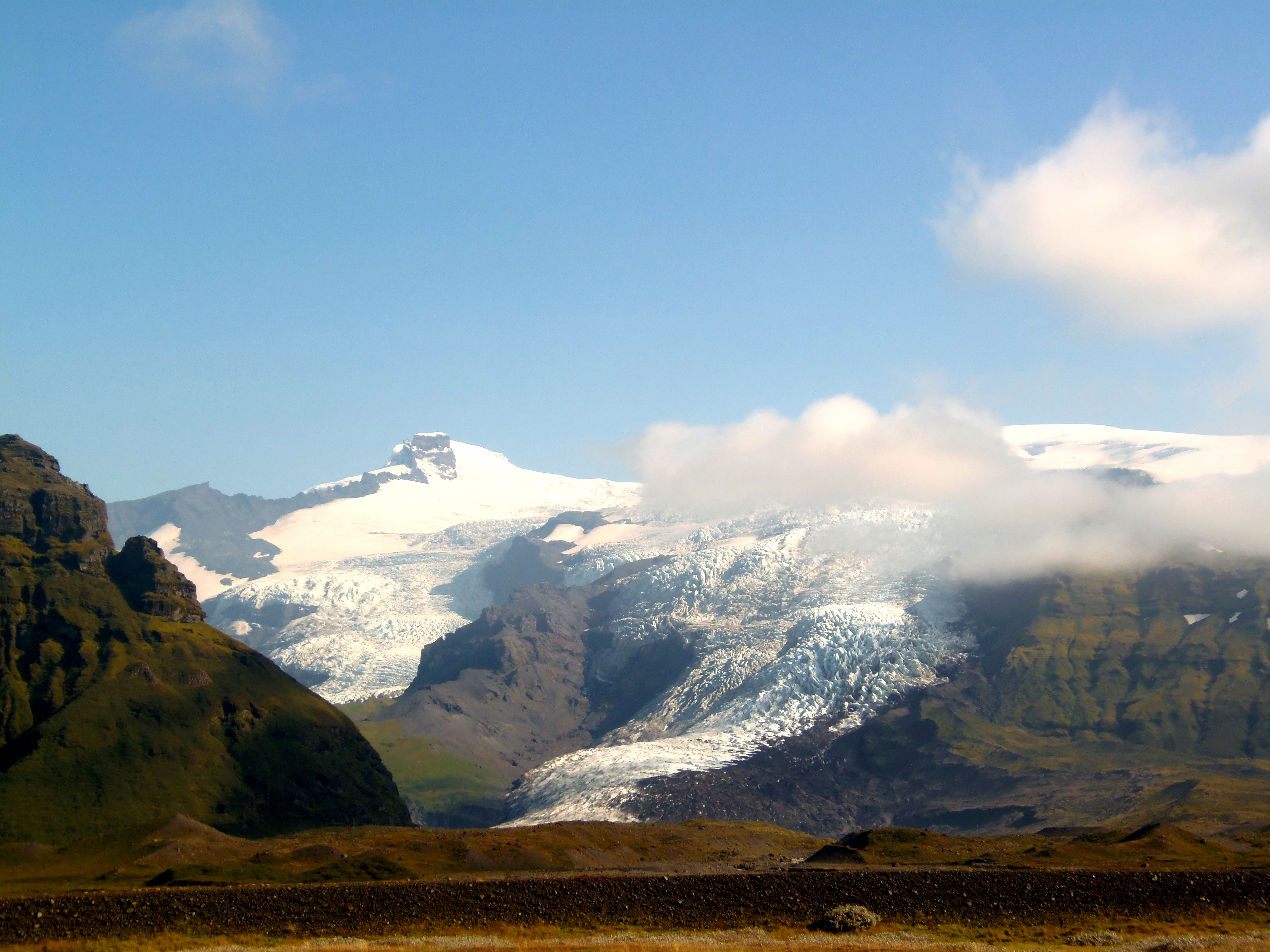
Jokulsarlon is the name of the lake that one of the tongues of Vatnajokull creates when melting near the sea. In the contact with liquid water, it drops icebergs, so the lake is full of these pieces of ice sailors.

This place is indeed highly visited by tourists, so don’t expect to be alone here. People get here by organized tours, local buses or on their own car, like we did. From the lake’s shore you can take an amphibious boat and ride though the lake. It is not necessary to book in advance (at least in September), you only have to ask the people in vest over there and they tell you when the next one is scheduled.
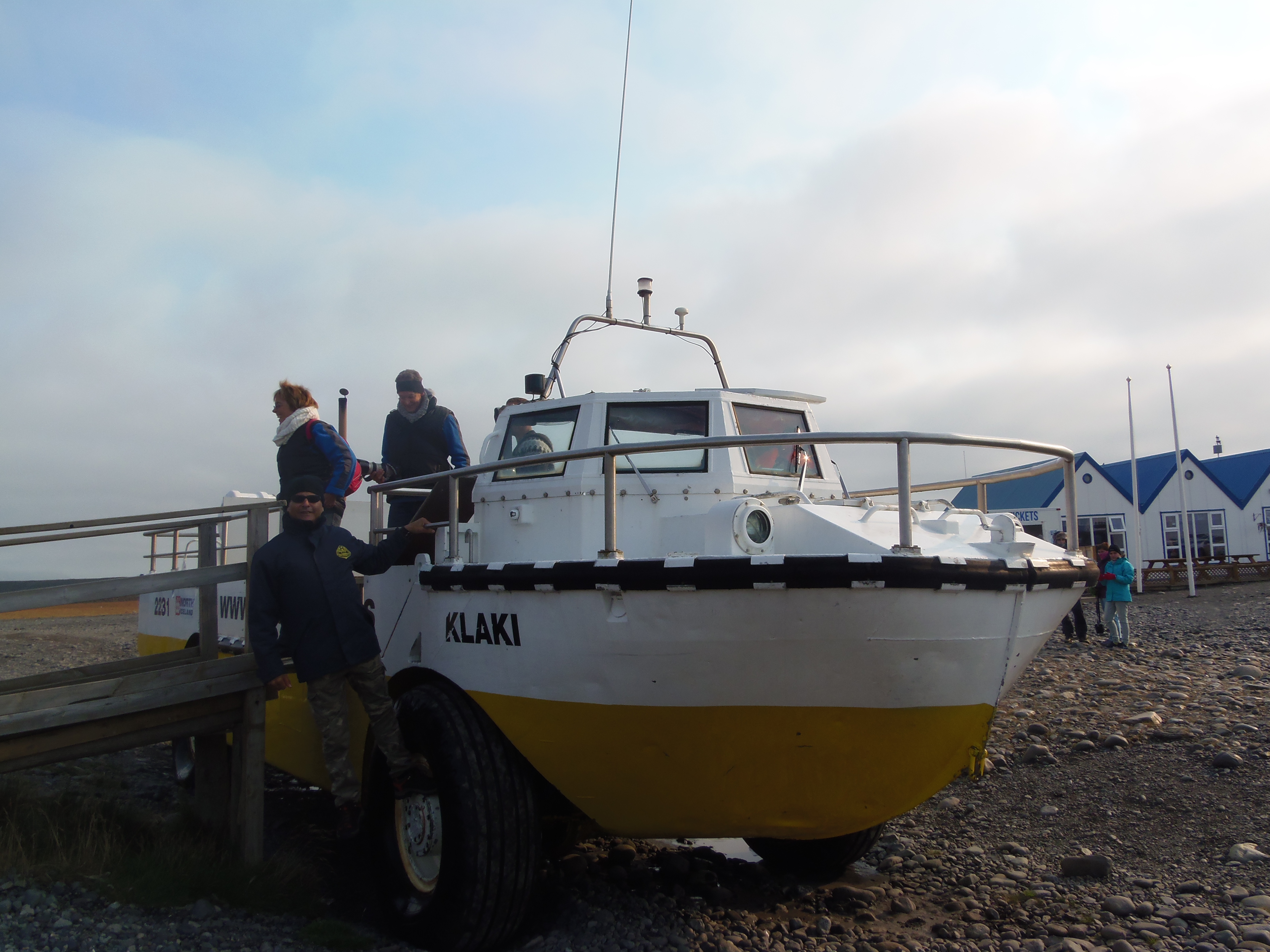
During the ride, you will be able to approach towards the glacier’s tongue and watch how it drops icebergs. Moreover, you may spot seals and much kind of sea birds. It was a very good experience; I took lots of pics as there were such magical postcards…

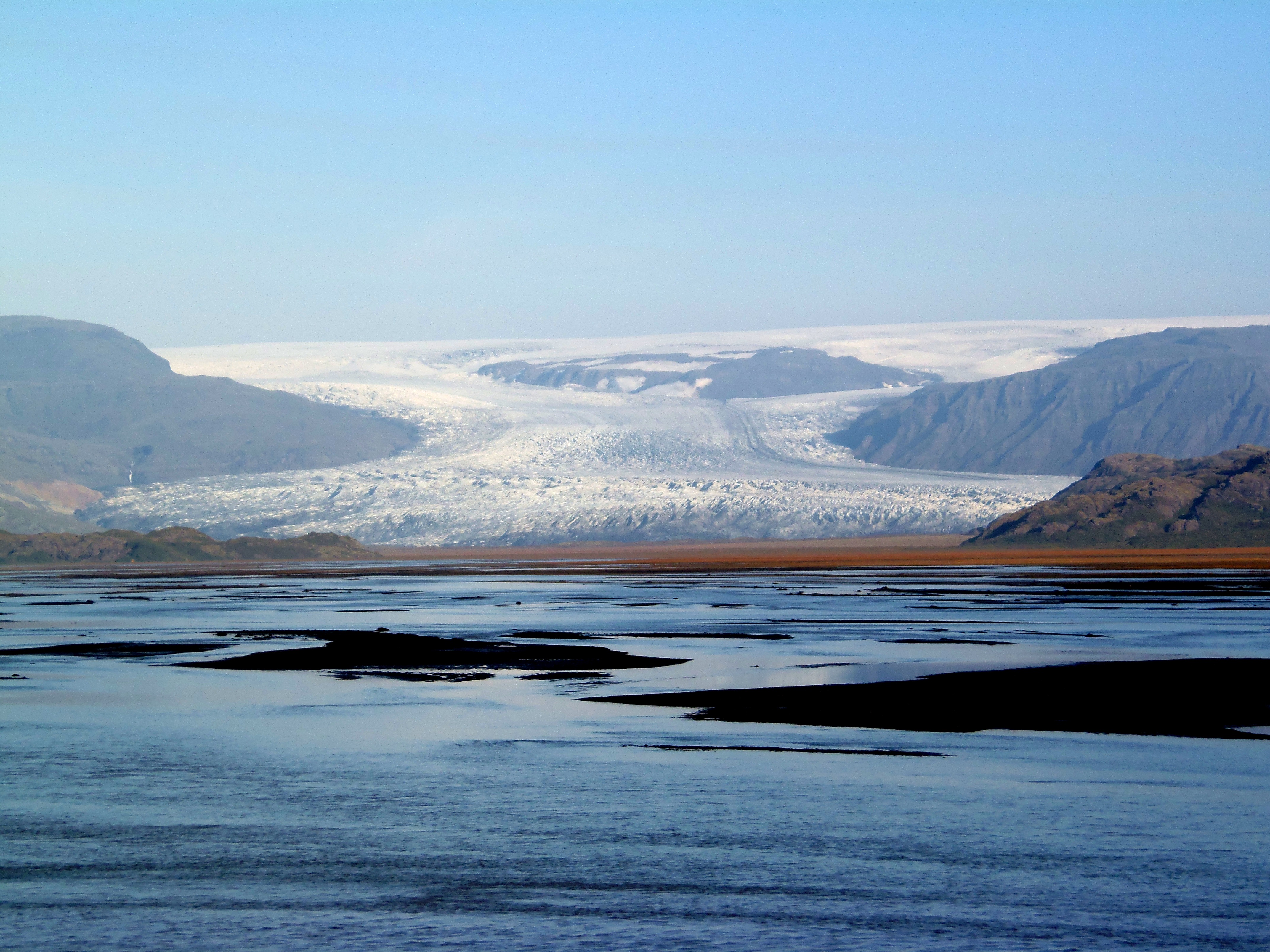
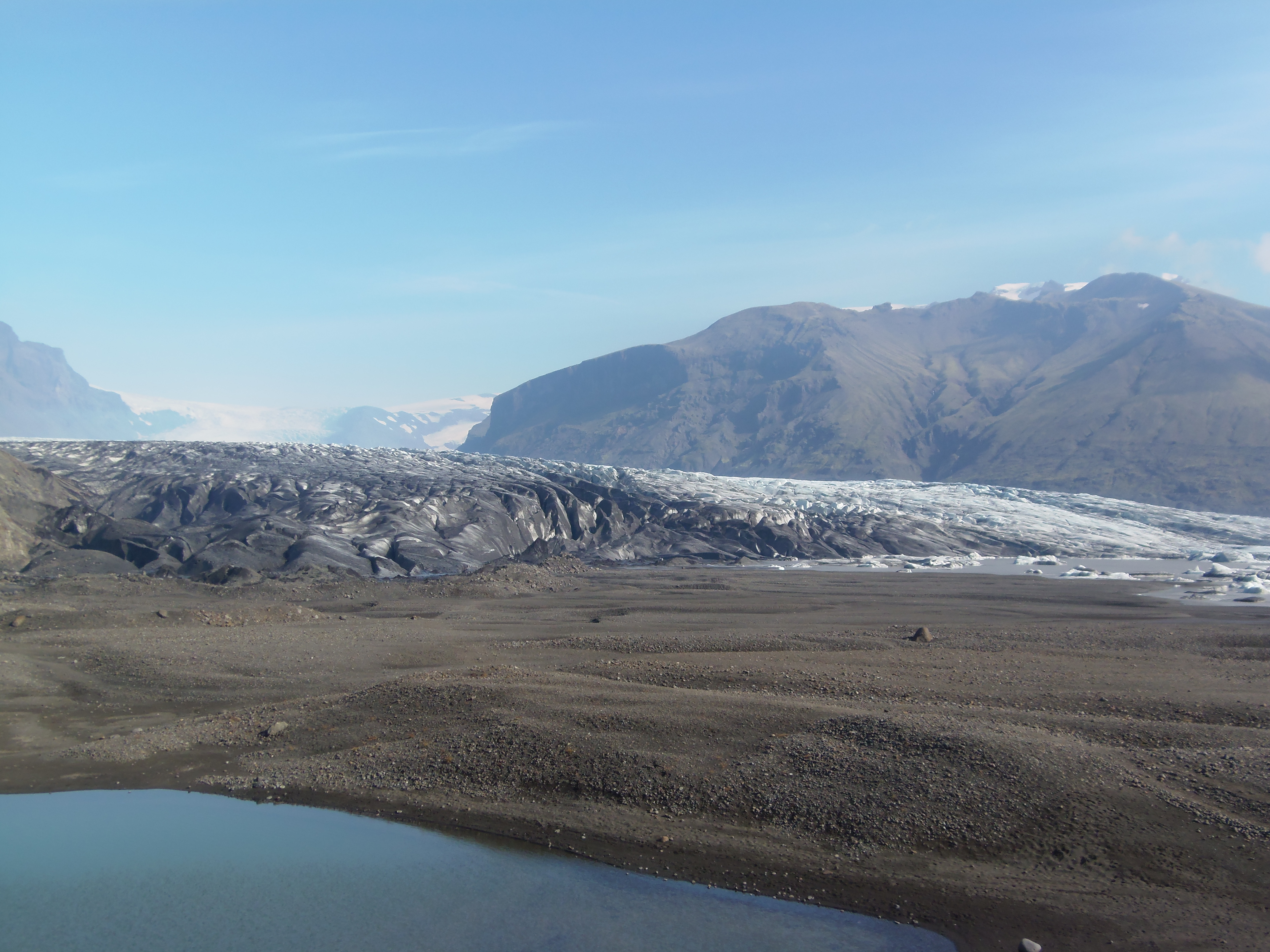
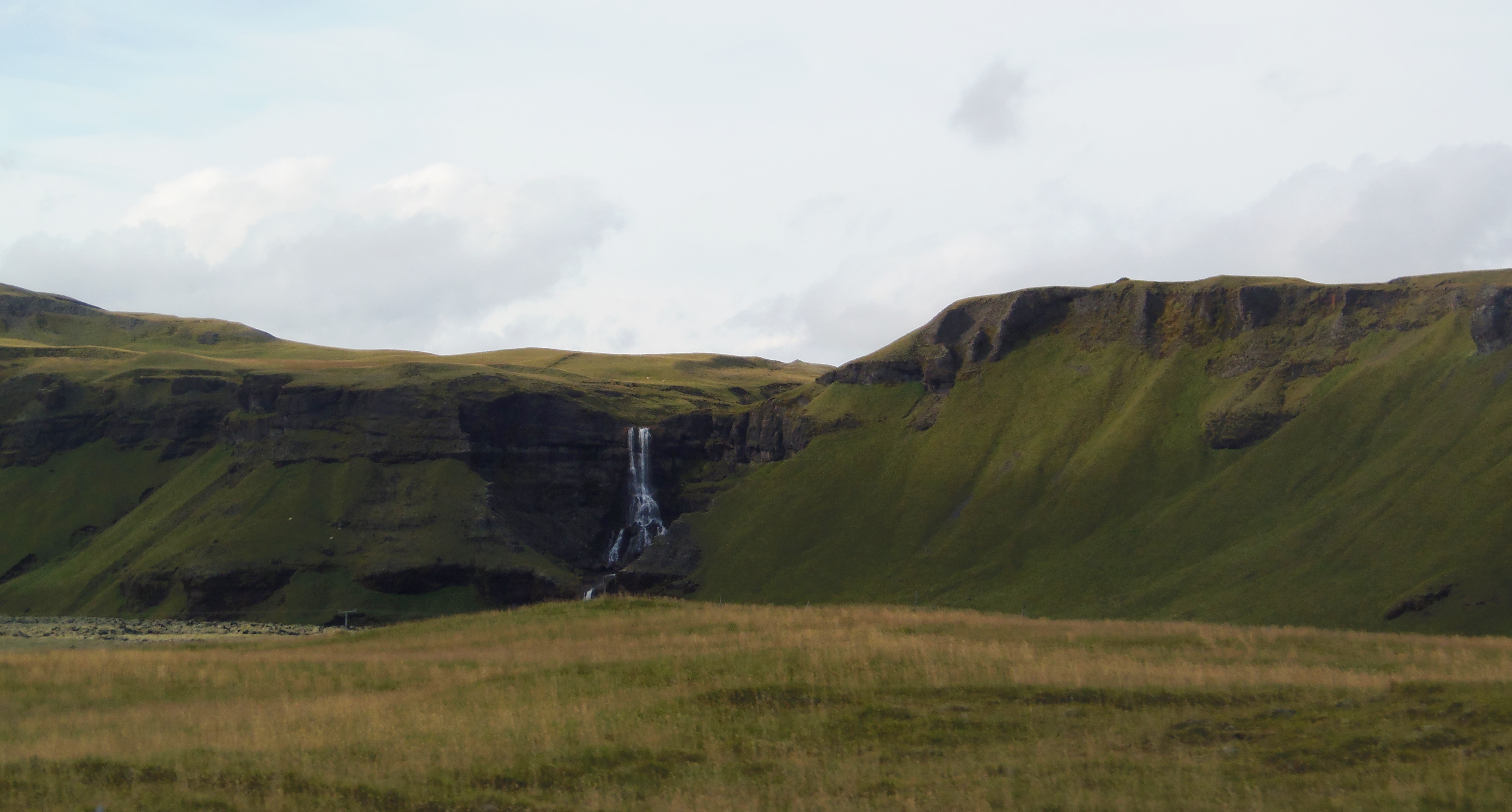
We left the lake with an extraordinary sensation. It was lunchtime so we decided to go to Skaftafell visitor’s center and grab something to eat there (to get there, take road 998). Then we went hiking in Skaftafell, which is a national park that includes several attractions such as waterfalls, rivers and glaciers.
There are many paths to follow, I suggest the two ones we did. Firstly, we walked the path to the east (standing opposite the main door, to the right) that took us until Skaftafelljokull. It’s the tongue of the so-called glacier, where we could see it from a short distance. A sign warned us about the risk of quicksand, and it was truly muddy, the ground was mixed with mud, water, ice…
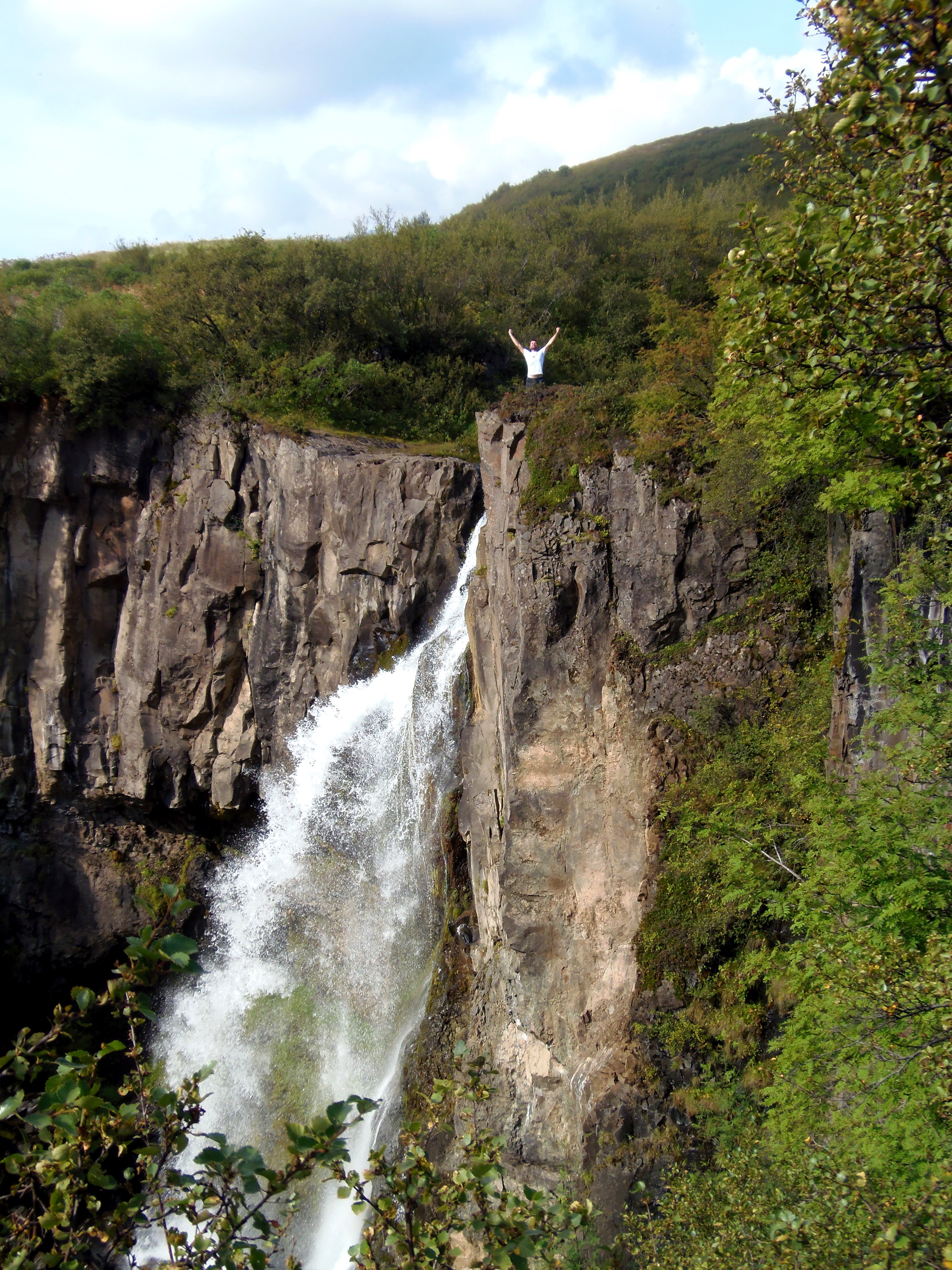
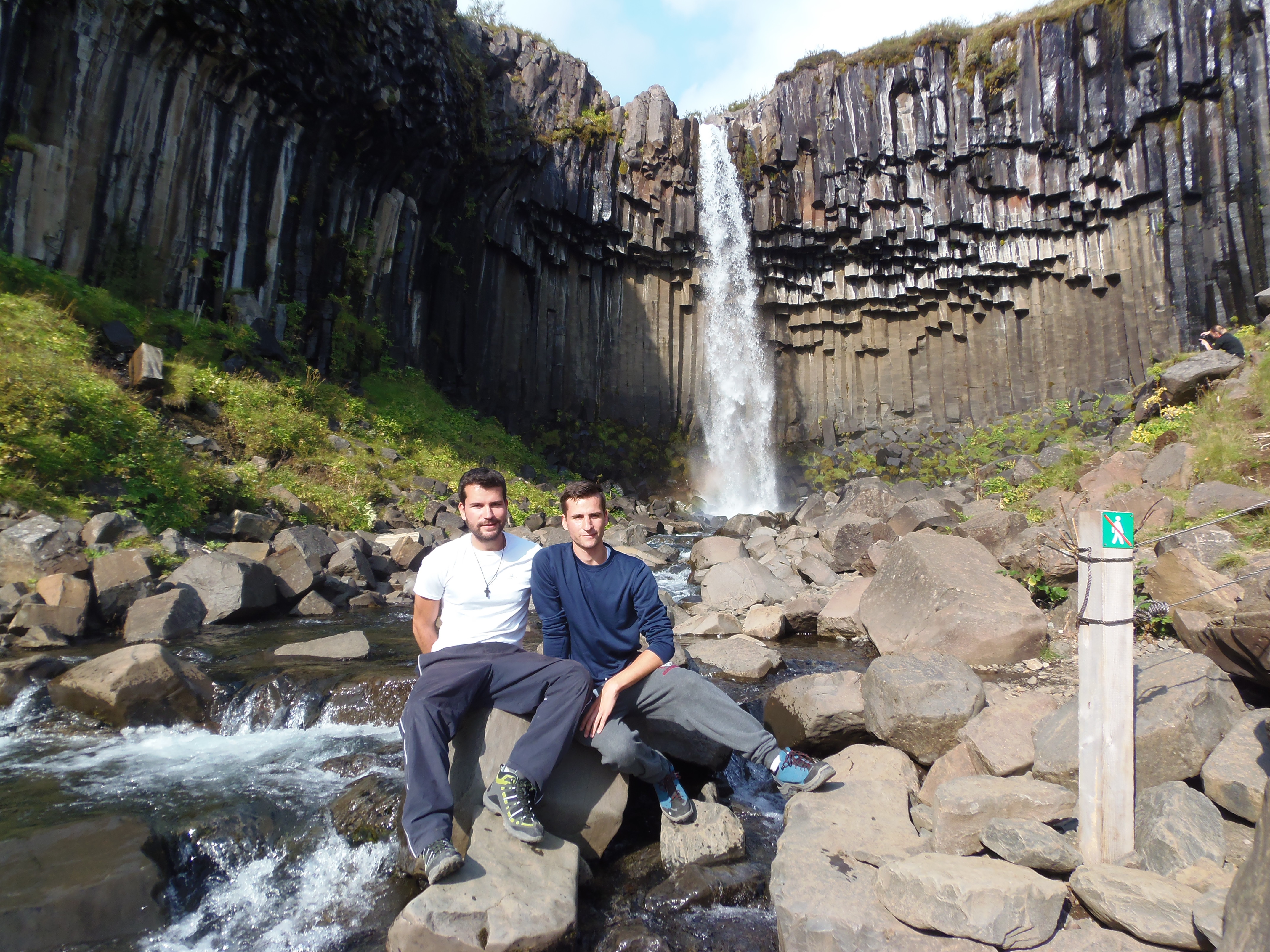
After having watched this site, we returned our way back to the visitor’s center, and now we took the path on the left (to the west). There is no glacier here, but a mountain path where you can see waterfalls, including Svartifoss (the famous black waterfall), which is well known for being an elegant one with volcanic tubes.

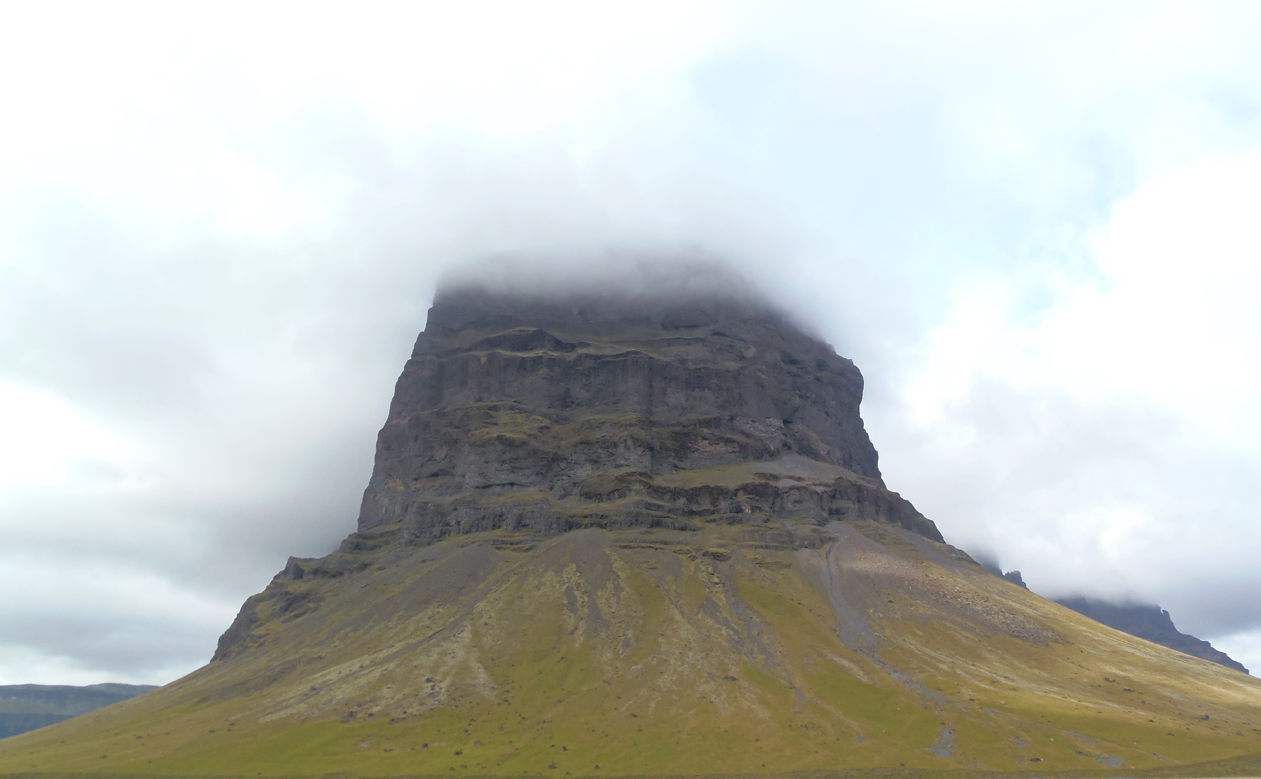
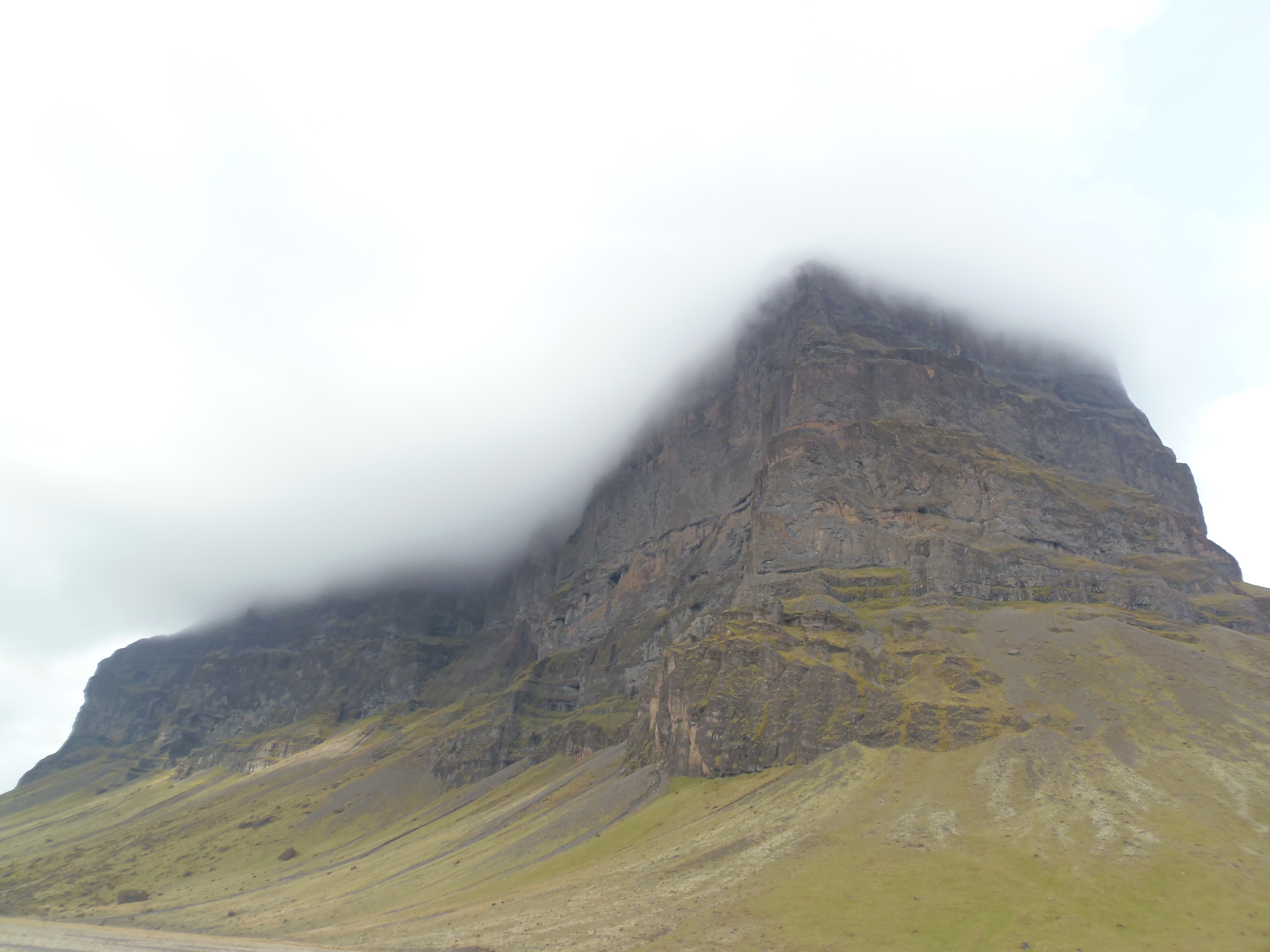
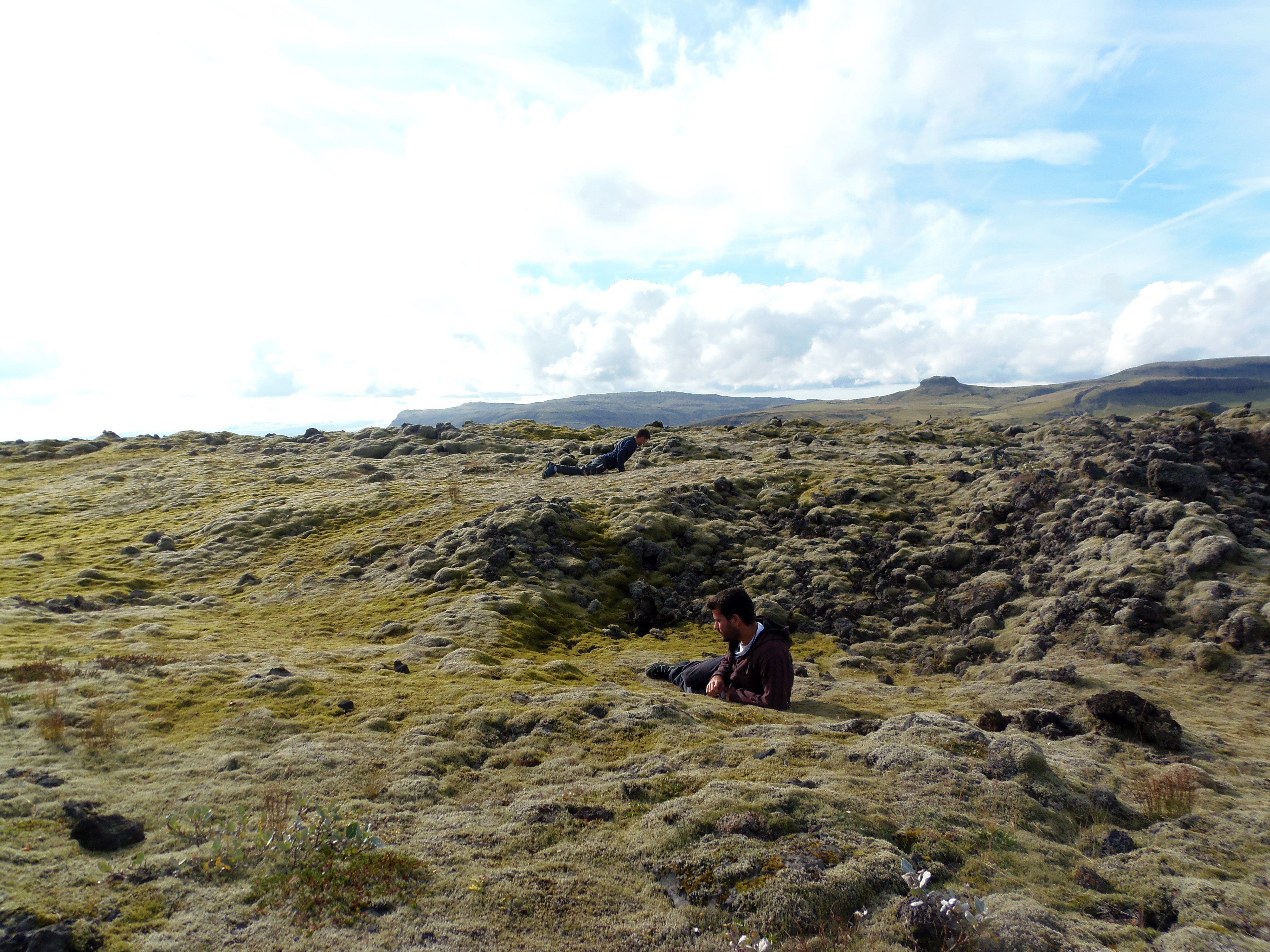
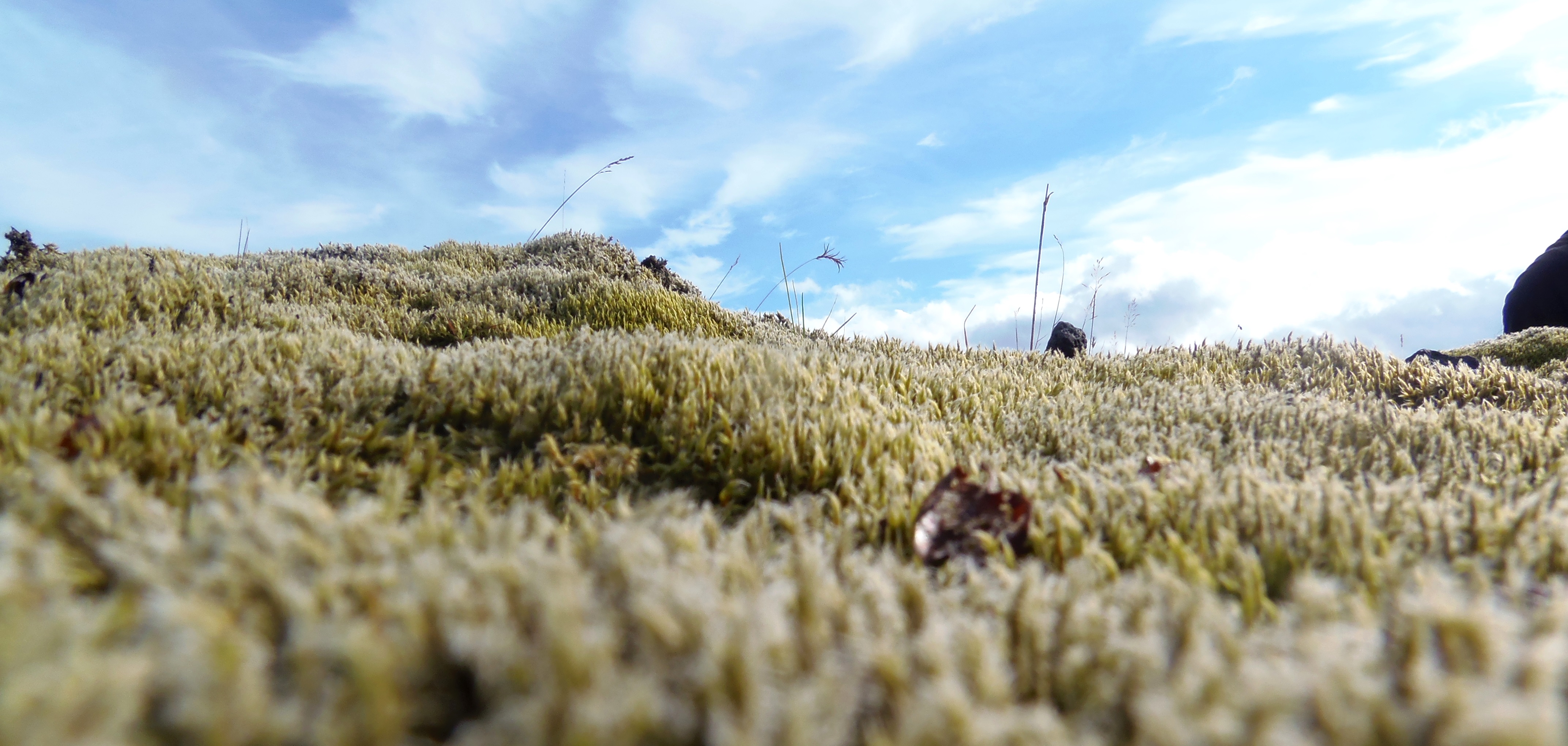
Once we had returned to our car, we were prepared to continue until Vik, the rainiest town of Iceland. On our way, I continued to feel astonished of the beauty of the Icelandic relief. And especially, of the soft moss prairies. We also saw little amounts of rocks (we didn’t know its meaning, then we learned they were created to honor the magical beings of the country (elves, fairies, trolls).
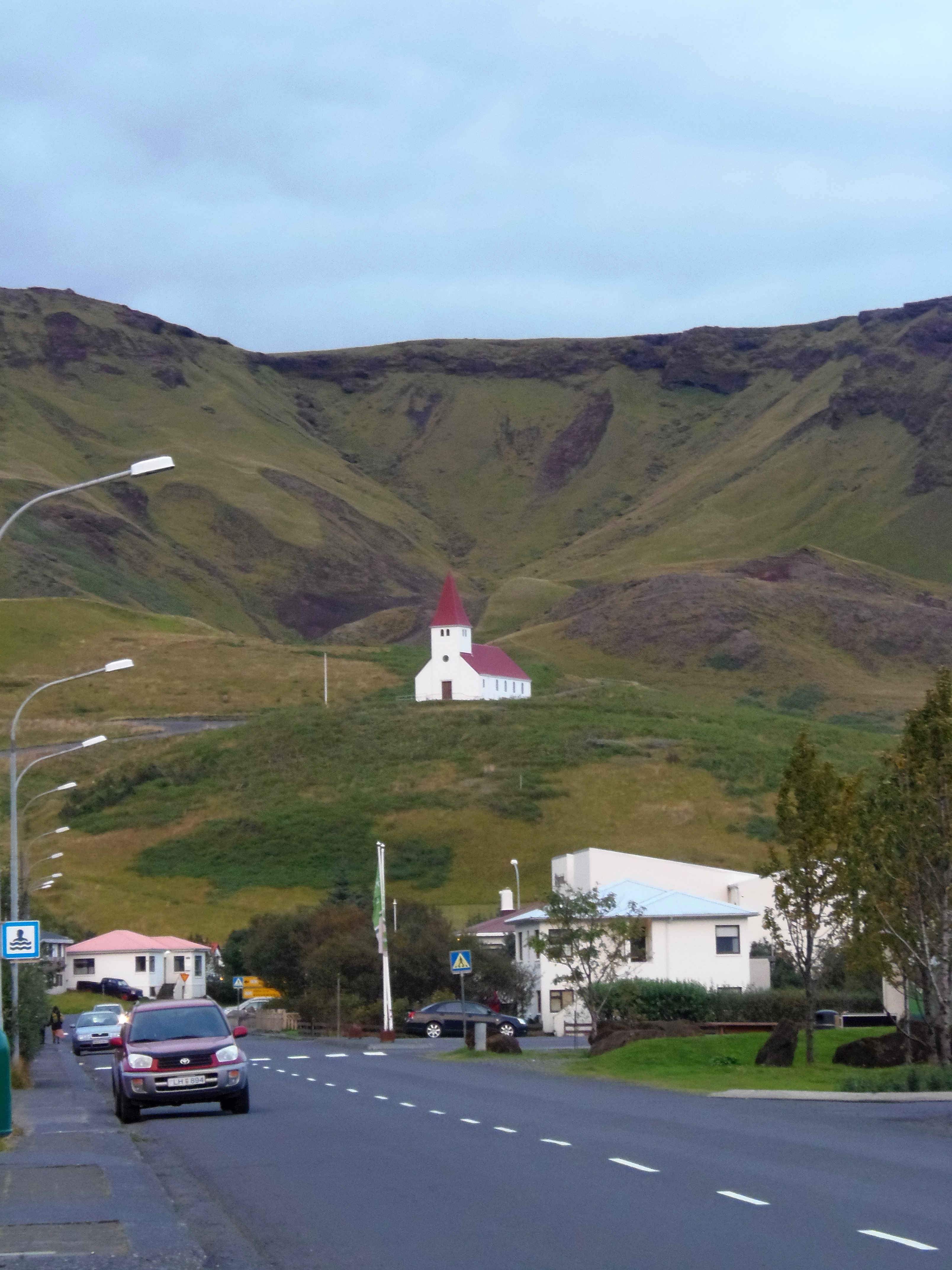
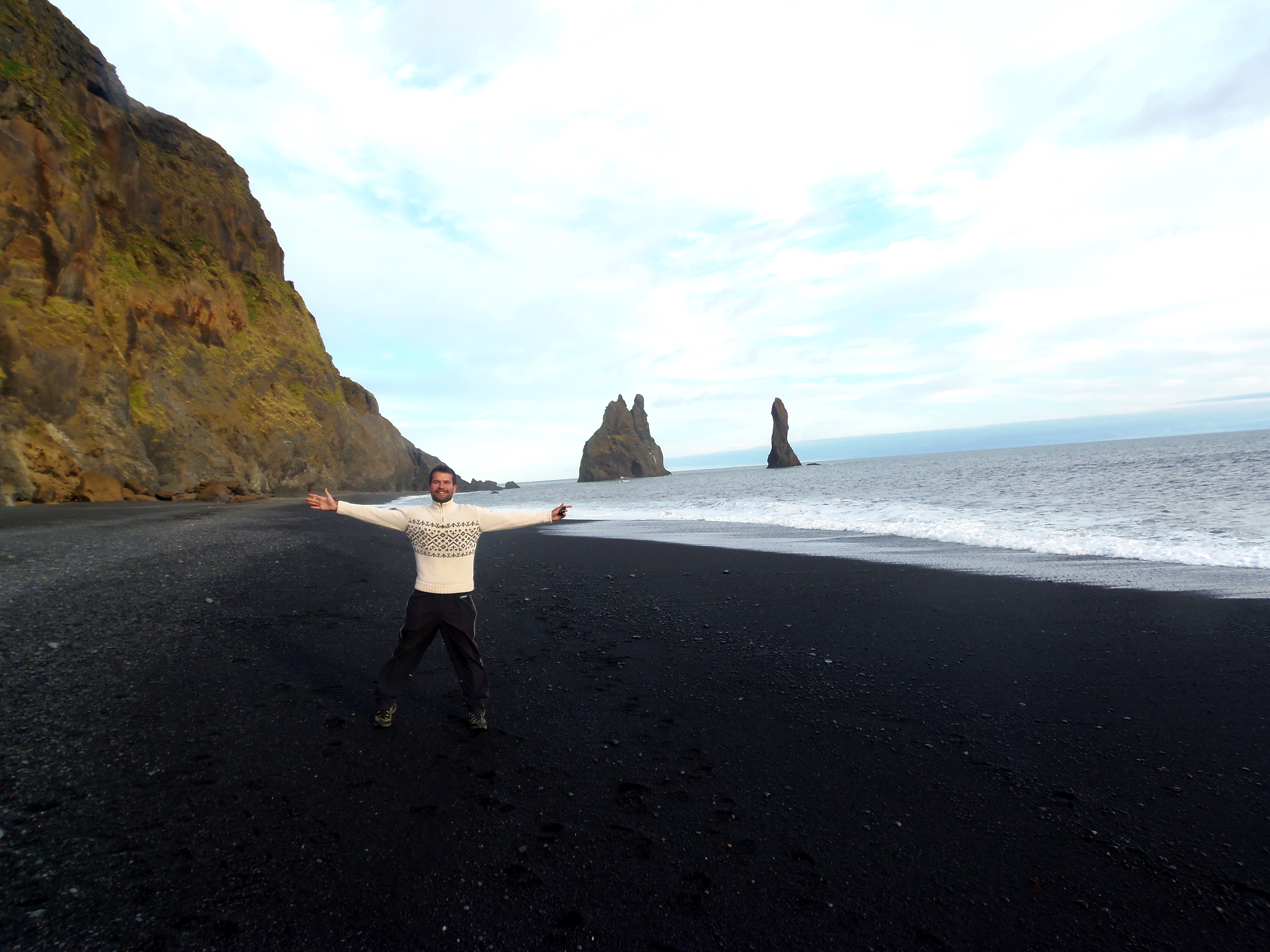
The small red and White church on top of a hill showed us our end of the journey: we were already in Vík. The first thing we did was climbing up to the church, and get a panoramic view of this town of only 300 inhabitants, that in spite of its small size, it is an important village due to its position midway the capital and the South coast.
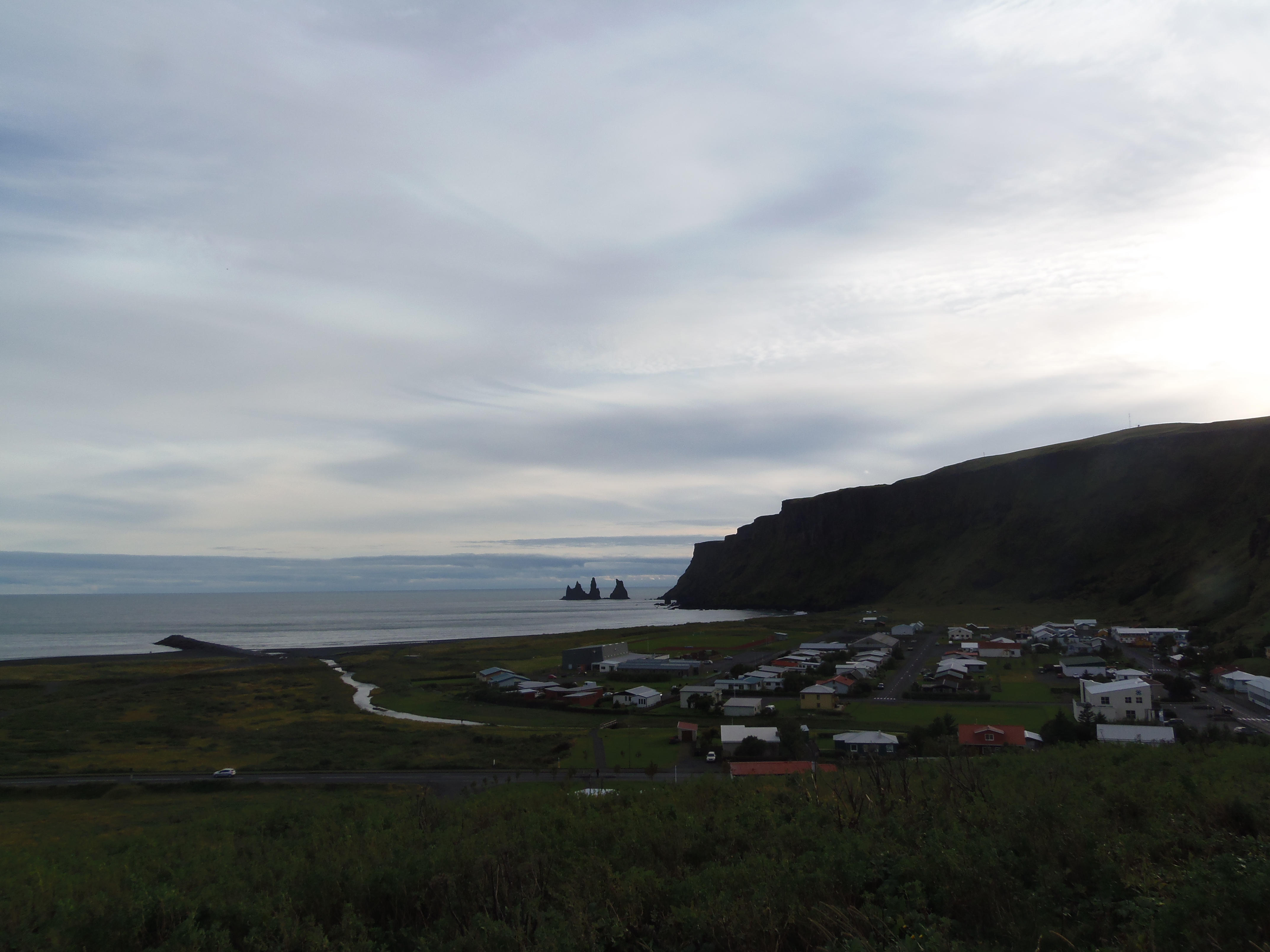
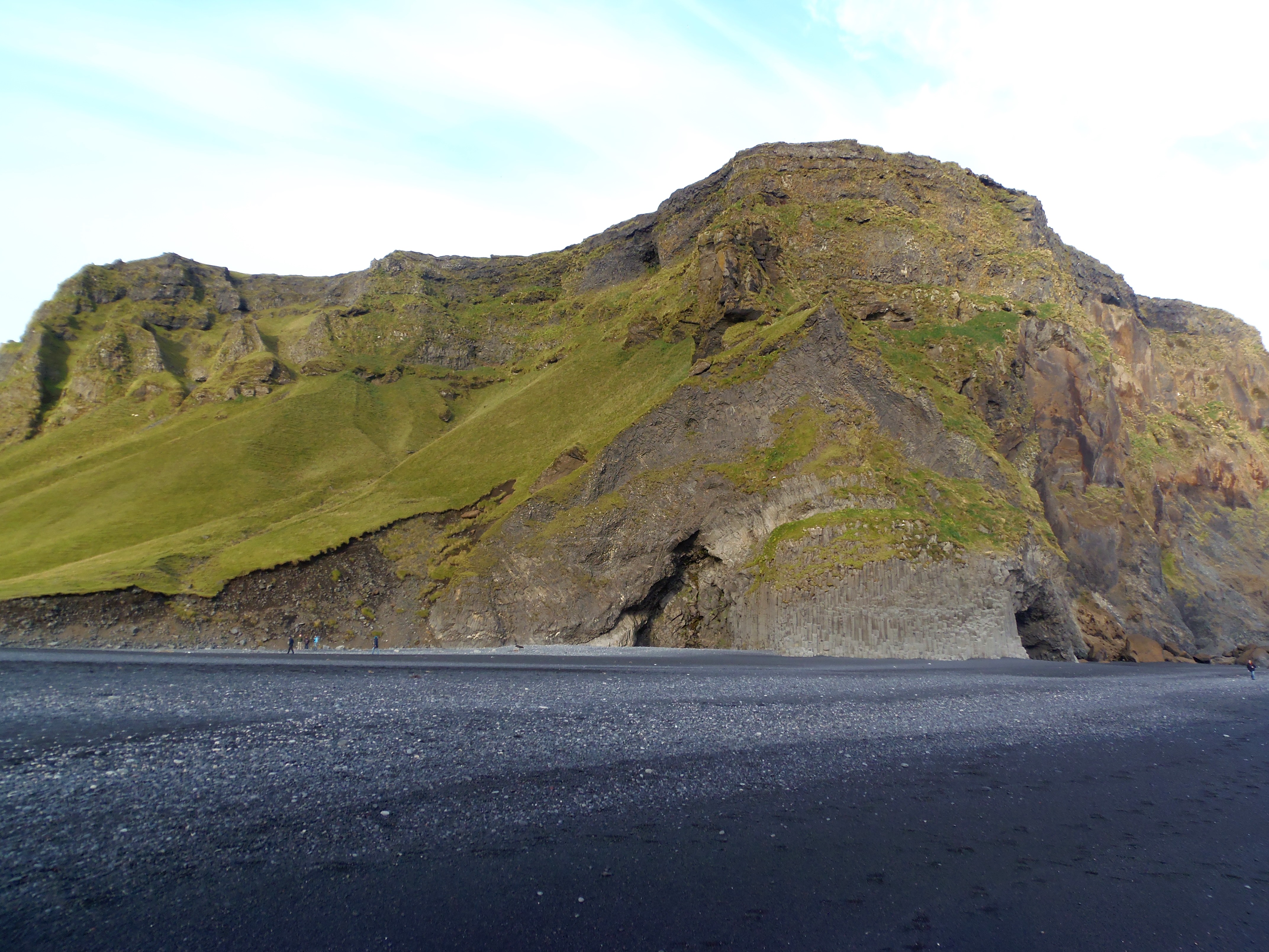
The best thing you can do in Vík is going to the black sand beach and watch the rocky formations there. At the South, in the distance, it is Dyrholaey, a rock complex with an arch; and the trolls, pinnacles just on the shore.
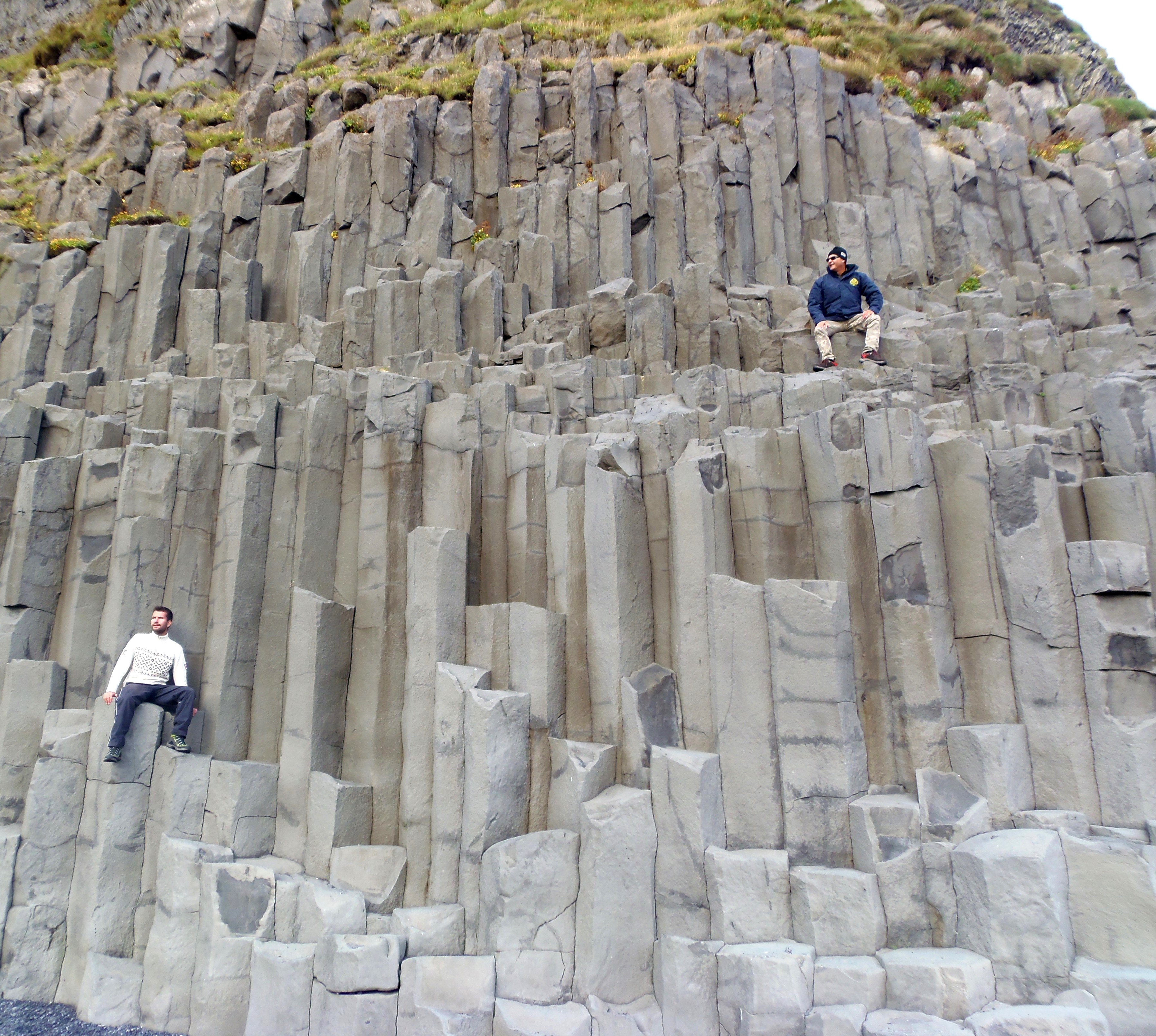
Furthermore, Vik’s beach is great: I spent a while thinking what was right in front of me, beyond the sea… If I chased the horizon, the Atlantic Ocean widely emerged, I was on the southernmost point of Iceland. I thought about how it was when the first human beings arrived in Island, and how their discovery was: reaching a violent volcanic island, cold in ice, but kind of character. And there I was, standing in a beach with great black sand, with a great green relief behind me, and my father doing great races up and down the hexagonal formations.

After this wonderful day, we slept in Hostel Puffin in Vík. I don’t recommend it at all. Rooms were so small, really. And showers, not better. I think it is closed currently.
Tomorrow was the day of our final section of the Ring Road. Read it here!